Twinworks enables 360° imagery and LiDAR capture to become structured asset information, and delivers the operational intelligence infrastructure owners need to plan, maintain, and act with confidence.
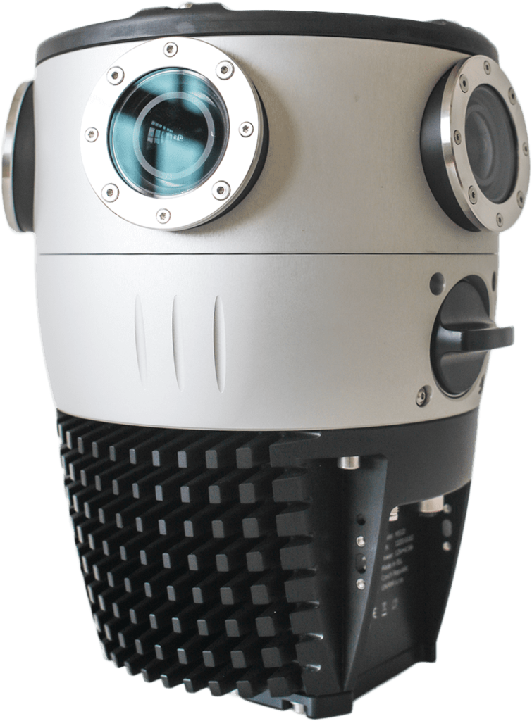
Mosaic X Mobile Mapping System
Twinworks is the exclusive authorized reseller for Mosaic in Canada
Most infrastructure owners manage assets using information that is months or years out of date. Inventories are incomplete. Condition data is expensive to collect. Manual workflows are slow and hard to scale. The result is planning, reporting, and operational decisions made under uncertainty — not on evidence.
Twinworks exists to close that gap.
A complete pipeline — hardware, software, and services — that turns what is in the field into structured, usable information.
Use a mobile mapping system like the Mosaic Meridian to capture your corridor — high-resolution 360° imagery and LiDAR with precise GPS positioning, at road speed, on any terrain. The Twinworks Driver app calculates the most efficient route to cover every street in as little driving as possible, and tracks progress across multi-day, multi-region capture programmes.
Hardware + field services
Twinworks processes raw imagery with AI models that identify and classify assets — signs, poles, hydrants, vegetation, pavement condition, and more — with location and attribute data attached. Automated condition assessment tools score asset health directly from imagery, eliminating the need for manual field grading on every inspection cycle.
Software + AI models
Structured asset data flows directly into the systems your organisation already uses — including PSD Citywide, IBM Maximo, and SAP — keeping records current without manual re-entry. One shared source of truth across the entire organisation means operations, maintenance, planning, and finance are all working from the same field-verified intelligence.
Integration + deliverables
Hardware, software, and services — available individually or as a complete programme.
Hardware
Twinworks is the exclusive authorized Mosaic reseller in Canada. We help you select, deploy, and operate the right camera system for your corridor.
Software
AI extraction, 360° workspaces, condition assessment, route planning, and GIS integration — in a collaborative platform built for infrastructure teams.
Services
Managed collection, AI model development, operator training, and hardware supply. We can run the whole programme or help you build the capability in-house.
Wherever physical infrastructure needs to be inventoried, assessed, and kept current — Twinworks can help.
Support asset management reporting, improve inventory accuracy, and reduce dependence on expensive consultant-led updates. Know what you own — and its condition.
Learn more →
Detect encroachments, monitor corridor change, and produce defensible inspection outputs faster than traditional field review workflows.
Learn more →
Inventory assets at scale. Identify condition issues and vegetation risks. Build repeatable assessment workflows that don't require boots on every pole.
Learn more →
Maintain current corridor visibility. Support compliance reporting and monitoring with structured field intelligence rather than manual notes.
Learn more →
Deliver higher-quality outputs faster. Build a scalable data collection and processing capability that becomes a competitive advantage.
Learn more →
Don't see your sector?
If your work involves identifying, assessing, or keeping track of physical infrastructure — we'd like to talk.
Infrastructure intelligence is the process of transforming imagery, LiDAR, sensor data, and field observations into structured, actionable information that supports operational, planning, compliance, maintenance, and investment decisions. It closes the gap between what exists physically in the field and what decision-makers actually know about their infrastructure.
Municipalities typically rely on a combination of as-built records, field inspections, GIS systems, and periodic consultant-led surveys. Maintaining current inventories is difficult because data becomes outdated faster than traditional update cycles allow. Twinworks addresses this by enabling vehicle-mounted 360° imagery collection that can be driven on a regular schedule, then processed automatically to extract and update asset records — making inventory updates faster and significantly less expensive than manual approaches.
AI models trained on 360° imagery can detect a wide range of infrastructure assets including traffic signs, streetlights, utility poles, fire hydrants, catch basins, pavement markings, curbs, trees, encroachments, and condition indicators such as cracking or surface deterioration. The specific assets detected depend on the models trained for each use case. Twinworks builds custom models for each customer's asset types and environment.
LiDAR (Light Detection and Ranging) captures precise 3D point clouds of the environment. Combined with 360° imagery, it enables accurate spatial measurements of assets — heights, distances, offsets, and clearances — that imagery alone cannot reliably provide. For infrastructure applications this means more accurate positioning of assets, better condition measurements, and the ability to detect subtle changes between collection passes.
No. Twinworks offers flexible engagement models. You can purchase Mosaic hardware to build an in-house collection capability, or Twinworks can provide managed collection services where our crews collect data on your behalf. The Twinworks platform processes imagery regardless of how collection was performed, so you can start with managed services and bring collection in-house as your programme matures.
You do. Data ownership and control are a core part of Twinworks' model. The platform can be deployed on-premise within your network, in a private cloud environment you control, or as a managed SaaS with clear data ownership terms. For public sector customers and organisations with data sovereignty requirements, on-premise deployment keeps all imagery, AI outputs, and asset records entirely within your own infrastructure.
Yes. Twinworks outputs are designed to feed into existing GIS and asset management platforms. Extracted asset data can be exported in GIS-ready formats compatible with ArcGIS and QGIS. The goal is to enhance the systems you already use — not replace them. Twinworks focuses on the data collection and intelligence layer; your existing systems remain the system of record.
Schedule a 30-minute conversation. We'll learn about your workflow and show you how Twinworks can help you collect better data, extract more from it, and make decisions with confidence.